S-100:引领航海未来 探索新一代数据标准将如何改变从船舶到岸基的决策方式。
发布时间:2025-06-23 15:13:32 访问次数:788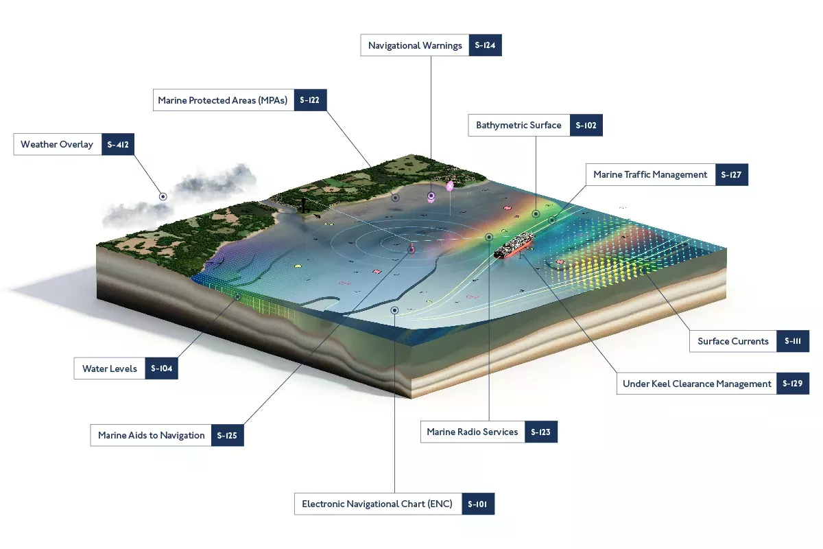
什么是S-100?
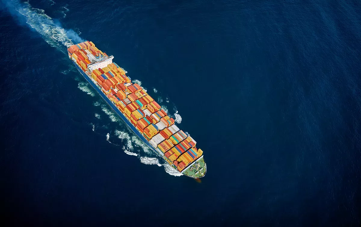
S-100是支撑下一代航海技术的新型数据框架。通过提供通用标准,S-100将提升海道测量与海洋数据的可获取性、兼容性和可用性,涵盖下一代电子航海图(ENCs)、水深测量、潮汐信息等。
这些新标准将丰富海事与地理空间用户共享和展示数据的方式。通过呈现更完整的海洋环境图景,用户能够基于精准、可靠且实时的海洋数据做出更明智的决策。
英国水文局处于S-100解决方案开发的前沿,通过创建测试新数据集并进行实际海上试验推动进展。
What is S-100?
S-100 is a new data framework that will underpin the next generation of navigation technologies. By providing a universal standard, S-100 will improve the accessibility, compatibility and usability of hydrographic and marine data. This will include the next generation of Electronic Navigational Charts (ENCs), bathymetry, tidal information and more.
These new standards promise to enrich the way data is shared and displayed for maritime and geospatial users. By offering a much more complete picture of the maritime environment, users will be empowered to make more informed decisions based on precise, accurate and timely marine data.
The UK Hydrographic Office is at the forefront of developing S-100 solutions by developing and testing new data sets and conducting real-world sea trials; keep up to date with the latest developments by subscribing to our S-100 mailing list.
S-100的优势
S-100将如何改变航海方式?
凭借动态数据层、更高精度和更强互操作性,支持S-100的新一代解决方案将优化从船舶到岸基的决策流程。从提升航行安全到实现经济与环境效益,深入了解基于S-100解决方案带来的实际效益。
Benefits of S-100
How will S-100 transform the way we navigate?
With dynamic data layers, greater granularity and improved interoperability, the next generation of S-100-enabled solutions will enhance the way decisions are made from ship to shore. From improving navigational safety to helping achieve economic and environmental efficiencies, find out more about the real-world benefits unlocked by S-100 based solutions.
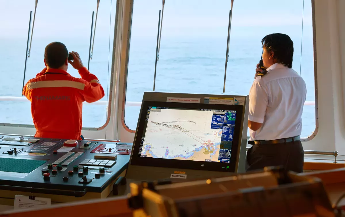
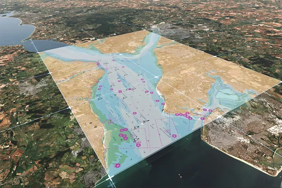
提升航行安全
通过整合多重数据图层至单一视图,S-100标准将增强驾驶台的态势感知与决策信心。
新一代S-101电子海图(ENCs)能提供界面简洁的ECDIS显示,显著提升操作效率;同时,强大的数据叠加功能可呈现高精度海底地形与实时潮汐动态信息,助力用户从容应对复杂水域航行挑战。
Supporting safety
By bringing multiple data layers into asingle view, S-100 will improve clarityand confidence on the bridge.
The next generation of S-101ENCs willprovide a clutter-free ECDlS display forbetter usability, while powerful dataoverlays will provide high-resolutionbathymetry and dynamic tidalinformation to help users navigatecomplex waterways with ease.
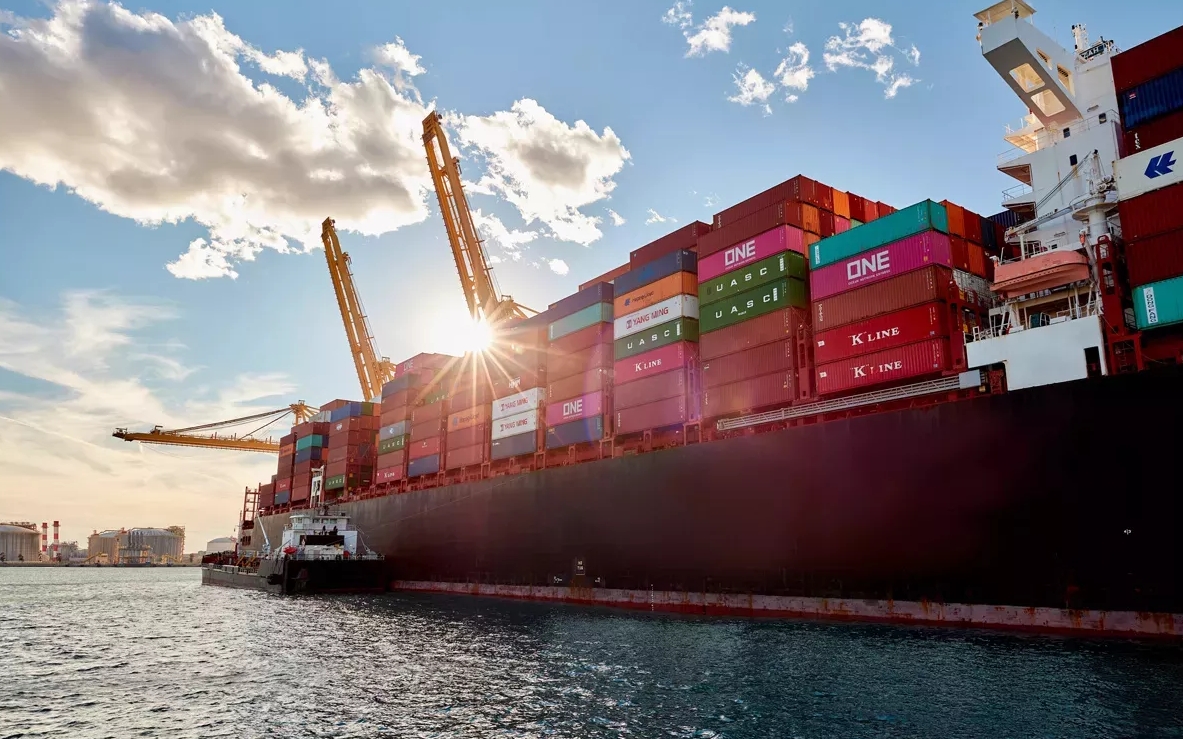
提升运营效率
S-100标准通过提供更精细、更实时的航行数据,将显著提升船舶至岸基的全链条运营效率。
该标准整合海底地形、水位与表层洋流数据,为用户提供动态海洋环境信息,从而为航行路线规划、货物装载以及港口进出等关键决策提供数据支撑,实现更高效的航运管理。
Enhancing efficiencies
With more granular and timely data, S-100 will help enhance efficiencies fromship to shore.
By combining bathymetry, water levelsand surface currents data, users willhave access to dynamic data on theocean environment and its conditions,providing the basis for more efficientdecisions around navigation, cargoloading, and port entry and exit.
航程优化
动态潮汐数据可支持基于实时条件的“准时到港”计算。
通过利用有利潮汐,用户能够优化燃油消耗,实现更高效的航程,从而减少排放,助力全行业脱碳进程。
Optimising voyages
Dynamic tidal data can supportcalculations for Just in Time arrivalsbased on real-time conditions.
By taking advantage of favourable tides,users can optimise their fuelconsumption for more efficientvoyages, reducing emissions andhelping to support industry-widedecarbonisation efforts.
面向未来航行
S-100数据的开发始终以未来航海导航为考量。
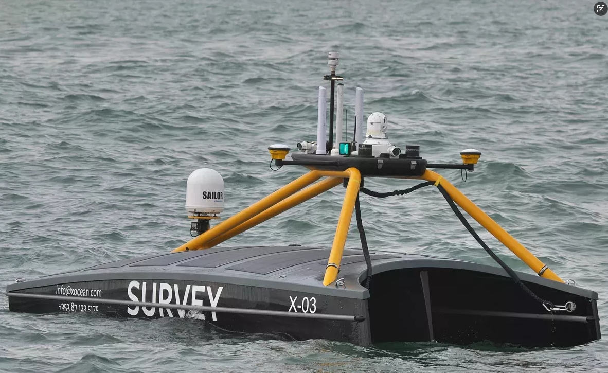
依托海事互联技术,S-100数据集将实现完全机器可读,确保其兼容未来的导航技术。这不仅将实现船舶自动化系统的无缝衔接,更将为远程操控船舶和未来无人驾驶船舶奠定基础。
Fit for the future
S-100 data is being developed with thefuture of navigation in mind.
Enabled by maritime connectivity, S-100 data sets will be fully machine-readable to ensure they are futureprooffor the navigational technologies oftomorrow. This will enable seamlesson-board automation, as well as layingthe foundations for remotelycontrolled and uncrewed vessels ofthe future.
lmage credit: XOCEAN
图片来源:XOCEAN
更多信息请联系:
北京思拓海洋信息技术有限公司
北京市丰台区汽车博物馆东路 6 号院盈坤世纪大厦 F 座 512室
电话:010 62680730
传真:010 62681683
邮箱:sales@enclive.cn